
The Unseen Navigator: AI-Driven Precision in the Skies
The hum of a drone is no longer an anomaly; it’s the sound of progress. As these aerial marvels become increasingly sophisticated, their integration into our daily lives and critical industries is accelerating at an unprecedented pace. At the heart of this revolution lies the sophisticated dance between hardware and software, where advanced materials meet intelligent algorithms, pushing the boundaries of what’s possible in unmanned aerial vehicles (UAVs). We are moving beyond simple aerial photography and towards a future where drones are indispensable tools for complex operations, from surveying vast agricultural fields to ensuring the safety of our airspace.
The Evolution of Aerial Intelligence
The evolution of drone technology is a testament to human ingenuity. Once limited by rudimentary controls and short flight times, modern drones are equipped with cutting-edge systems that grant them autonomy and precision previously unimaginable. AI-driven navigation is a cornerstone of this advancement, enabling drones to perceive their environment, make real-time decisions, and execute complex flight paths with minimal human intervention. This intelligence is further enhanced by sophisticated sensors, such as thermal imaging sensors, which allow drones to ‘see’ heat signatures, proving invaluable for search and rescue operations, infrastructure inspection, and even monitoring wildlife. The development of robust obstacle avoidance technology ensures these intelligent machines can navigate dynamic environments safely, whether it’s a dense forest or a busy urban landscape, minimizing the risk of collisions and ensuring mission success.
Precision Agriculture and Beyond
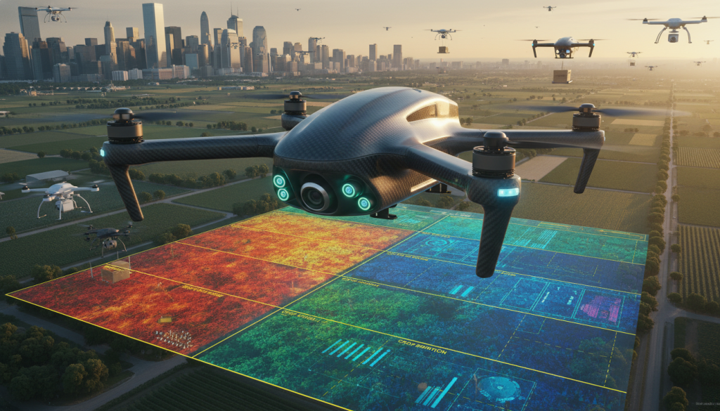
The agricultural sector has been one of the earliest and most significant beneficiaries of advanced drone technology. Precision agriculture drones equipped with multispectral and hyperspectral cameras can analyze crop health, identify nutrient deficiencies, and detect early signs of disease with remarkable accuracy. This data, often processed using techniques like photogrammetry mapping, allows farmers to optimize irrigation, fertilization, and pest control, leading to increased yields and reduced environmental impact. The ability to conduct detailed aerial surveys also aids in land management, soil analysis, and monitoring crop growth over time. Imagine a drone, powered by efficient brushless motor technology and utilizing Real Time Kinematic (RTK) positioning for centimeter-level accuracy, meticulously surveying a vast field, identifying stressed areas, and then communicating this data wirelessly via 5G connectivity for immediate action by ground crews or other autonomous systems.
Logistics and Infrastructure in the Air
The potential for drones in logistics is immense. Delivery drone logistics are rapidly moving from concept to reality, promising faster, more efficient, and potentially more sustainable transportation of goods, especially in urban and remote areas. This requires drones capable of carrying significant weight, hence the development of heavy lift payload capabilities. Furthermore, maintaining control and communication over long distances is crucial, which is where long range telemetry systems come into play, ensuring reliable data transfer and command and control even when the drone is out of sight. The integration of Edge Computing UAV capabilities allows for on-board processing of data, reducing latency and enabling faster decision-making, especially critical for autonomous operations and complex missions.
Safety, Security, and the Future of Flight
As drone usage proliferates, so does the need for robust safety and security measures. Remote identification systems are becoming mandatory, allowing authorities to identify and track drones in operation, enhancing airspace security and preventing misuse. In scenarios where unauthorized drones pose a threat, advanced solutions like kinetic drone interception are being developed to safely neutralize them. The pursuit of longer flight times and greater sustainability is also driving innovation in power sources. Hydrogen powered drones, for instance, offer the promise of significantly extended flight durations and reduced environmental impact compared to traditional battery-powered systems. The use of lightweight yet durable materials like carbon fiber airframes further enhances performance, allowing for greater payload capacity and improved aerodynamic efficiency.
The Symphony of Swarms and Seamless Connectivity
Perhaps one of the most fascinating frontiers in drone technology is the concept of swarm intelligence. By coordinating multiple drones to work collaboratively, complex tasks can be accomplished with greater efficiency and resilience. Imagine a swarm of drones mapping a disaster zone, each drone contributing its piece of the puzzle to create a comprehensive 3D model, or a fleet of drones performing synchronized aerial displays. This level of coordination is facilitated by advanced communication protocols and the increasing ubiquity of high-speed networks like 5G. For specialized applications requiring detailed aerial perspectives, the integration of First Person View (FPV) systems allows for an immersive piloting experience, offering unparalleled control and situational awareness, especially for intricate maneuvers or inspections. The continuous refinement of these technologies, from their power sources and airframes to their navigation and communication systems, paints a clear picture of a future where autonomous aerial systems are not just a novelty, but an integral part of our infrastructure, our industries, and our everyday lives, performing tasks with a level of precision and intelligence that continues to redefine the boundaries of possibility.