
Navigating the Future: The Symphony of Autonomous Flight Systems and Precision Agriculture
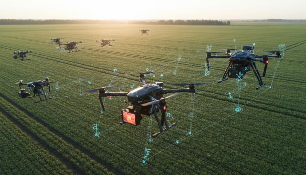
The hum of a drone, once a novelty, is rapidly becoming a familiar soundscape, heralding a new era of efficiency and insight. At the heart of this transformation lie sophisticated Autonomous Flight Systems, orchestrating aerial missions with an intelligence that rivals, and in some cases surpasses, human capability. These systems are not merely pre-programmed flight paths; they are dynamic, adaptive entities capable of processing vast amounts of data in real-time, making critical decisions to ensure mission success and safety. This intelligence is particularly vital in fields like Precision Agriculture, where the ability to monitor vast tracts of land with unparalleled accuracy can mean the difference between a bountiful harvest and significant loss.
The Eyes of the Sky: Precision Agriculture Drones
Precision Agriculture Drones are revolutionizing how we tend to our fields. Equipped with advanced sensors, these UAVs act as the eyes of the sky, providing farmers with granular data about crop health, soil conditions, and pest infestations. Thermal Imaging Sensors, for instance, can detect subtle temperature variations that indicate stress in plants long before visible signs appear, allowing for targeted interventions. This level of detail, gathered from high-altitude perspectives, enables a proactive approach to farming, optimizing resource allocation – water, fertilizers, and pesticides – only where and when they are needed. This not only boosts yields but also significantly reduces environmental impact.
Swarm Intelligence and AI Driven Navigation
The concept of a single drone meticulously surveying a field is evolving. The power of Swarm Intelligence is now being harnessed, where multiple drones, communicating and coordinating with each other, can cover larger areas more efficiently. This collective intelligence, guided by AI Driven Navigation, allows for complex tasks like large-scale mapping or simultaneous monitoring of different crop zones. Imagine a swarm of drones, each acting as an independent agent yet contributing to a unified mission, sharing data and adjusting their flight paths dynamically to avoid collisions and optimize coverage. This is not science fiction; it’s the cutting edge of aerial operations.
Enhanced Perception: Obstacle Avoidance and Real-Time Kinematic Positioning
Operating in complex environments, whether it’s a dense forest or a busy agricultural landscape, demands robust safety features. Obstacle Avoidance Technology is paramount, employing a suite of sensors like LiDAR and ultrasonic detectors to create a real-time 3D map of the surroundings, allowing drones to navigate safely around trees, power lines, or other airborne vehicles. Complementing this is Real Time Kinematic (RTK) Positioning. Unlike standard GPS, RTK offers centimeter-level accuracy, crucial for applications like precise spraying or detailed photogrammetry mapping where exact location data is critical. This fusion of avoidance and precision positioning ensures that drones can operate reliably and safely, even in challenging terrains.
Extending Reach and Capability: Long Range Telemetry and Heavy Lift Payloads
The operational range of drones is constantly being pushed. Long Range Telemetry systems ensure that operators maintain a stable, high-bandwidth connection with their aircraft, even when operating miles away. This is essential for missions spanning vast agricultural areas or for infrastructure inspection routes. Furthermore, the payload capacity of drones is increasing dramatically. Heavy Lift Payload capabilities mean that drones are no longer limited to just sensor data collection; they can now carry significant loads, opening doors for applications like aerial delivery of essential supplies to remote farms or even the deployment of monitoring equipment.
The Foundation of Flight: Carbon Fiber Airframes and Brushless Motor Efficiency
Beneath the advanced sensors and intelligent software lie the fundamental engineering marvels that enable these drones to take flight and perform. The use of advanced materials like Carbon Fiber Airframes provides a remarkable strength-to-weight ratio. These lightweight yet incredibly durable structures are essential for maximizing flight time and payload capacity. Equally important is the efficiency of their propulsion systems. Modern Brushless Motor Efficiency ensures that power is converted into thrust with minimal energy loss, further extending endurance and performance. These seemingly mundane components are the bedrock upon which sophisticated aerial capabilities are built.
The Future is Now: Hydrogen Power, 5G, and Edge Computing
Looking ahead, the potential for further advancements is immense. Hydrogen Powered Drones offer the promise of significantly extended flight times, potentially hours or even days, compared to current battery limitations. The integration of 5G Connectivity is set to revolutionize data transmission, enabling near-instantaneous communication and control, crucial for complex swarm operations and real-time data analysis. Moreover, Edge Computing UAV platforms are bringing processing power directly to the drone, allowing for immediate data analysis and decision-making without the need to transmit raw data back to a ground station. This localized intelligence is a game-changer for time-sensitive applications and enhanced autonomy. These technological leaps are not isolated; they are converging to create an ecosystem of aerial vehicles that are more capable, efficient, and intelligent than ever before, fundamentally reshaping industries from agriculture to logistics and beyond, ensuring a future where the sky is not a limit, but a vast, intelligent frontier.