
The Sky’s No Limit: How Advanced Drone Technology is Reshaping Industries
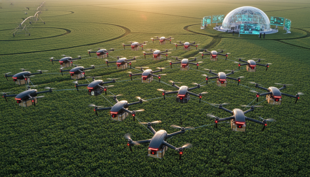
The rapid evolution of drone technology has moved far beyond hobbyist gadgets and military surveillance. Today, a sophisticated array of autonomous flight systems, coupled with cutting-edge sensors and communication protocols, is fundamentally transforming industries from agriculture and logistics to infrastructure inspection and public safety. At the heart of this revolution lies the increasing intelligence and capability packed into these unmanned aerial vehicles (UAVs), enabling them to perform complex tasks with unprecedented efficiency and precision.
Precision Agriculture: Cultivating Smarter Farming
Precision agriculture drones are a prime example of how UAVs are driving innovation. Equipped with advanced sensors like thermal imaging sensors, these drones can fly over vast fields and gather detailed data on crop health, soil moisture, and pest infestations. AI-driven navigation ensures they cover every inch of the terrain systematically, while Real-Time Kinematic (RTK) positioning provides centimeter-level accuracy for mapping and targeted interventions. Farmers can then use this data to optimize irrigation, fertilization, and pesticide application, leading to higher yields, reduced waste, and a more sustainable approach to food production. The ability to identify subtle variations in plant health early on, invisible to the naked eye, is a game-changer, allowing for proactive rather than reactive management.
Revolutionizing Logistics with Delivery Drones
The dream of autonomous delivery drones is rapidly becoming a reality. Delivery drone logistics are being optimized through sophisticated software that manages fleets, plans optimal routes, and ensures safe landings. Obstacle avoidance technology is paramount here, employing a combination of sensors like LiDAR and cameras to navigate complex urban environments and avoid collisions with buildings, power lines, and other aircraft. Long-range telemetry and 5G connectivity are crucial for maintaining constant communication and control over extended distances, even in areas with patchy traditional network coverage. Heavy lift payload capabilities are also expanding, allowing drones to transport larger and heavier packages, opening up possibilities for delivering medical supplies to remote areas or essential goods in disaster zones.
The Power of Swarms and AI in the Air
Beyond individual drone capabilities, the concept of swarm intelligence is opening up new frontiers. Imagine hundreds or even thousands of drones working collaboratively, coordinated by AI algorithms, to perform tasks such as large-scale mapping, search and rescue operations, or even complex aerial construction. This collective intelligence allows for greater efficiency, redundancy, and adaptability than any single drone could achieve. Edge computing UAV platforms further enhance this by enabling on-board data processing, reducing reliance on constant ground communication and allowing for faster decision-making in dynamic situations. This distributed intelligence means that even if some drones in a swarm encounter issues, the mission can continue uninterrupted.
Advanced Flight and Imaging Capabilities
The physical construction and flight dynamics of drones are also seeing significant advancements. Fixed-wing VTOL (Vertical Take-Off and Landing) designs offer the best of both worlds: the hovering capabilities of multi-rotors and the speed and endurance of fixed-wing aircraft, making them ideal for long-range surveillance and mapping missions. Carbon fiber airframes contribute to lighter, stronger, and more aerodynamic designs, enhancing flight performance and endurance. Brushless motor efficiency is constantly being improved, leading to longer flight times and greater power output. For specialized applications, thermal imaging sensors are becoming more sensitive and affordable, enabling detailed inspections of power grids, buildings for heat loss, and even search and rescue operations at night or in low-visibility conditions. Photogrammetry mapping, powered by high-resolution cameras and sophisticated software, allows for the creation of incredibly detailed 3D models of terrain, structures, and infrastructure, invaluable for planning, monitoring, and maintenance.
Ensuring Safety and Security in the Skies
As drone usage proliferates, safety and security become paramount concerns. Remote identification systems are being developed and implemented to allow authorities to identify drones operating in their airspace, similar to how vehicles are registered. For more proactive security, kinetic drone interception technologies are emerging, providing non-destructive or destructive methods to neutralize rogue or dangerous drones. The integration of these safety features alongside advanced flight systems ensures that the skies remain safe for both manned and unmanned aviation. The ongoing development in areas like hydrogen-powered drones also promises longer endurance and reduced environmental impact, further expanding the operational envelope and sustainability of UAV applications across the board. The convergence of these technological advancements paints a picture of a future where aerial autonomy is not just a possibility, but an integral part of our daily lives and industrial operations, driving efficiency, safety, and innovation at times, pure wonder.