
The Sky’s the Limit: How Advanced Drones Are Revolutionizing Industries
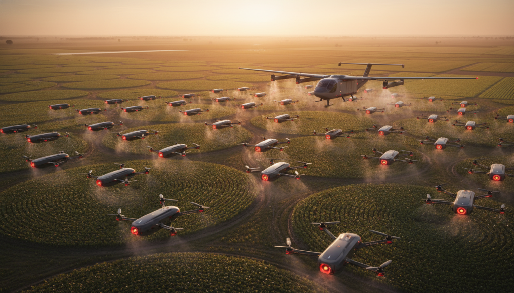
The drone industry is no longer a niche playground for hobbyists and military applications. It has exploded into a sophisticated ecosystem, driven by relentless innovation in autonomous flight systems, advanced sensor technology, and increasingly powerful AI. These unmanned aerial vehicles (UAVs) are rapidly transforming industries, from the way we farm to how we deliver goods, and even how we protect our airspace. The sky, once a mere conduit for travel, is becoming a dynamic operational space, managed and navigated with an intelligence that was science fiction just a decade ago.
Precision Agriculture: Sowing the Seeds of Efficiency
Perhaps one of the most impactful areas of drone adoption is precision agriculture. Gone are the days of blanket spraying and uniform fertilization. Precision Agriculture Drones, equipped with sophisticated sensors, are enabling farmers to monitor their crops with unparalleled detail. Thermal imaging sensors can detect subtle differences in plant health, identifying stress, disease, or water deficiencies long before they are visible to the human eye. This granular data, processed through AI-driven navigation and analysis, allows for targeted interventions, optimizing resource allocation and significantly reducing waste. Imagine a drone flying over a vast field, its AI precisely identifying a small patch of struggling corn, then directing a targeted application of nutrients or pesticides only to that specific area. This level of precision not only boosts yields but also minimizes environmental impact, aligning agriculture with sustainable practices.
The Future of Delivery: Beyond the Last Mile
The dream of drone-delivered packages is rapidly becoming a reality, thanks to advancements in delivery drone logistics. These systems are moving beyond experimental phases, tackling complex challenges like urban navigation and payload management. Innovations in obstacle avoidance technology, powered by advanced sensors and AI, allow drones to safely navigate busy airspace, avoiding buildings, power lines, and other aircraft. Furthermore, the development of heavy lift payload drones means that not only small parcels but also larger, more substantial items can be transported efficiently. The integration of 5G connectivity ensures reliable, high-bandwidth communication between drones and ground control, enabling real-time data transfer and remote operation. This is crucial for maintaining situational awareness and ensuring the safety and efficiency of delivery networks.
Enhanced Situational Awareness: From Farming Fields to Flight Paths
The ability to see and understand the environment is paramount for any autonomous system. Drones are increasingly equipped with advanced imaging capabilities. Photogrammetry mapping allows for the creation of highly detailed 3D models of terrain, infrastructure, and even disaster zones, providing invaluable data for planning and assessment. For applications requiring immediate, on-site decision-making, edge computing UAVs are proving revolutionary. By processing data directly on the drone, rather than sending it to a remote server, these systems can react instantaneously to changing conditions, a critical advantage in dynamic environments. This not only speeds up operations but also reduces reliance on constant, high-bandwidth communication, making operations more robust.
Pushing the Boundaries: Power, Range, and Control
The physical limitations of drones are constantly being challenged. The development of hydrogen powered drones promises significantly longer flight times and greater endurance, opening up possibilities for extended surveillance, long-range inspection, and more ambitious mapping projects. Coupled with long range telemetry systems, these aircraft can communicate effectively over vast distances, maintaining control and data flow even in remote or challenging terrains. The use of lightweight yet incredibly strong carbon fiber airframes contributes to both endurance and payload capacity, while advancements in brushless motor efficiency ensure that every ounce of power is utilized effectively. For applications demanding pinpoint accuracy, Real Time Kinematic (RTK) positioning provides centimeter-level accuracy, essential for tasks like precise surveying or automated landing sequences.
The Evolving Landscape of Airspace Management
As the skies become more populated with autonomous systems, effective management and security are critical. Remote identification technologies are being developed to ensure that every drone in the air can be uniquely identified, akin to a license plate for aircraft. This is a vital step towards integrating drones safely into existing airspace. Furthermore, the emergence of kinetic drone interception systems represents a new frontier in airspace security, providing a non-destructive or destructive means to neutralize rogue or dangerous drones. The concept of swarm intelligence, where multiple drones cooperate and communicate autonomously to achieve a common goal, is also paving the way for complex coordinated operations, from search and rescue to large-scale environmental monitoring. The integration of these advanced technologies signifies a profound shift, moving from individual, remotely piloted machines to a cohesive, intelligent network operating in three dimensions.